
WM-Survey II
1 ming+
Yuklanmalar

3+
info
Bu ilova haqida
We’re excited to announce the launch of our new Survey app. The goal of the app is to improve your efficiency by reducing the time to survey, designing and building water management systems.
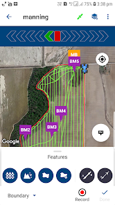
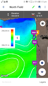
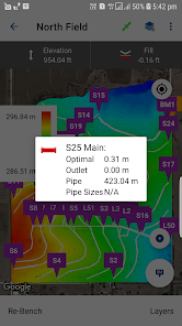
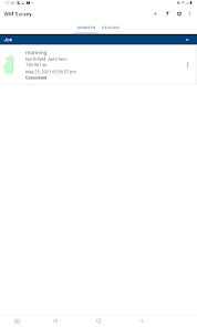
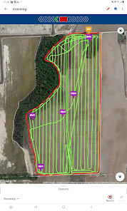
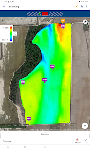
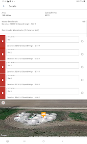
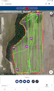
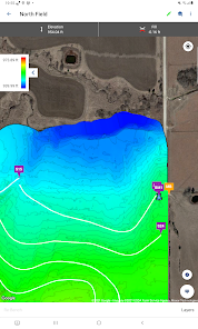
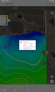
This is a Field Topographic & feature mapping app for Android devices. It is designed to collect data to allow users to automatically create basic surface drainage designs; 3D surface control files; and Feature Line Guidance for Trimble displays and a mobile application. The app will improve your efficiency by reducing the time to survey, design, and building water management systems to the same day.
This is a Field Topographic & feature mapping app for Android devices. It is designed to collect data to allow users to automatically create basic surface drainage designs; 3D surface control files; and Feature Line Guidance for Trimble displays and a mobile application. The app will improve your efficiency by reducing the time to survey, design, and building water management systems to the same day.
Oxirgi yangilanish
Xavfsizlik — dastur ishlab chiquvchilar maʼlumotlaringizni qanday jamlashi va ulashishini tushunishdan boshlanadi. Maʼlumotlar maxfiyligi va xavfsizlik amaliyotlari ilovadan foydalanish, hudud va yoshga qarab farq qilishi mumkin. Bu axborot dastur ishlab chiquvchi tomonidan taqdim etilgan va keyinchalik yangilanishi mumkin.

Tashqi hamkorlarga hech qanday axborot ulashilmagan
Dastur ishlab chiquvchilar axborot ulashilishini qanday aytishi haqida batafsil

Hech qanday maʼlumot jamlanmagan
Dastur ishlab chiquvchilar axborot jamlanishini qanday aytishi haqida batafsil

Maʼlumotlar uzatish vaqtida shifrlanadi

Maʼlumotlarni oʻchirishni soʻrashingiz mumkin
Nima yangiliklar
What's new:
- Data export of benchmarks and landmarks only.
- Feature designs included and can be exported as a .gps file.
- PTx Trimble branding.
Bug Fixes:
-Fixed: Units mismatched between Survey and Design.
-Fixed: Elevations not displayed at the same accuracy as the drainage settings.
-Fixed: Boundary error creating “bowtie” when duplicate points are recorded.
-Fixed: Incorrect folder on export and occasional empty folder on export.
-Fixed: The slope calculation between landmarks.
Ilova yuzasidan yordam
Dasturchi haqida
Trimble Inc.
10368 Westmoor Dr
Westminster, CO 80021
United States
+1 937-245-5500


