
WM-Survey II
1 Tsg.+
Downloads

PEGI 3
info
Über diese App
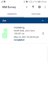
We’re excited to announce the launch of our new Survey app. The goal of the app is to improve your efficiency by reducing the time to survey, designing and building water management systems.
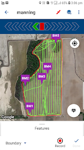
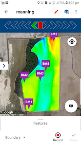
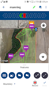
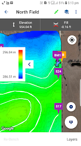
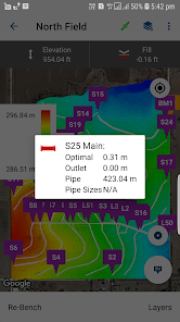
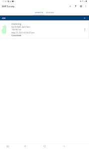
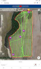
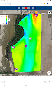
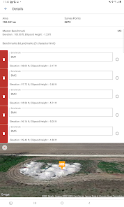
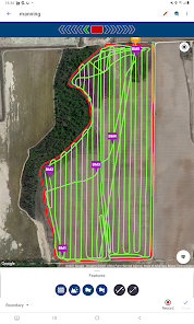
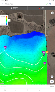
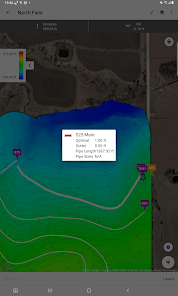
This is a Field Topographic & feature mapping app for Android devices. It is designed to collect data to allow users to automatically create basic surface drainage designs; 3D surface control files; and Feature Line Guidance for Trimble displays and a mobile application. The app will improve your efficiency by reducing the time to survey, design, and building water management systems to the same day.
This is a Field Topographic & feature mapping app for Android devices. It is designed to collect data to allow users to automatically create basic surface drainage designs; 3D surface control files; and Feature Line Guidance for Trimble displays and a mobile application. The app will improve your efficiency by reducing the time to survey, design, and building water management systems to the same day.
Aktualisiert am
Was die Sicherheit angeht, solltest du als Erstes verstehen, wie Entwickler deine Daten erheben und weitergeben. Die Datenschutz- und Sicherheitspraktiken können je nach deiner Verwendung, deiner Region und deinem Alter variieren. Diese Informationen wurden vom Entwickler zur Verfügung gestellt und können jederzeit von ihm geändert werden.

Keine Daten werden mit Drittunternehmen oder -organisationen geteilt

Keine Daten erhoben

Daten werden bei der Übertragung verschlüsselt

Du kannst das Löschen der Daten beantragen
Neuerungen
What's new:
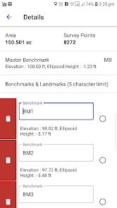
- Data export of benchmarks and landmarks only.
- Feature designs included and can be exported as a .gps file.
- PTx Trimble branding.
Bug Fixes:
-Fixed: Units mismatched between Survey and Design.
-Fixed: Elevations not displayed at the same accuracy as the drainage settings.
-Fixed: Boundary error creating “bowtie” when duplicate points are recorded.
-Fixed: Incorrect folder on export and occasional empty folder on export.
-Fixed: The slope calculation between landmarks.
Support für diese App
Informationen zum Entwickler
Trimble Inc.
10368 Westmoor Dr
Westminster, CO 80021
United States
+1 937-245-5500


